THE WEST CENTRAL FLORIDA
WEATHER CENTER


CONTENTS PAGE FOUR
This webpage is a combination of personal observations from the Busch Gardens Tampa Bay area,links to other sites and
information on severe weather conditions. The information
is free so don't be afraid to bookmark anything you like.
Don't forget to tell a friend!
Meteorology & Weather Resume
- University So. Florida Major in Geography 1972
- Dr.Dewey Stowers Head of Geography Dept.
Instructor
- Member Tripod Weather Pod
- Member Central Atlantic Storm Investigators
- Member Weather Ring
- Member Weather Watchers On-Line
- Member Florida Weatherwatchers
- Member Southwest Florida Water Management
District Rainfall Reporting Network
- Member Wx4u Weather Observers Network
- Observed Weather Conditions Locally for 25 years
- Knowledge of Radar - 4yrs Experience USAF
MEMBER
of the POD |
 | |
RAINFALL STATISTICS for BROOKSVILLE, FL from 2002 Forward/Busch Gardens Tampa Bay Prior to 2002 >
Month 2006 2005 2004 2003 2002 2001 2000 1999 Avg. Record-Year
- Jan .02 1.09 3.29 .08 4.18 .60 1.80 3.04 1.99 8.02 1948
- Feb 5.24 2.03 7.15 6.94 2.52 .92 .12 *0.29 3.08 10.82 1998
- Mar .05 3.21 2.32 5.90 1.96 *6.96 .57 *0.95 3.01 12.64 1959
- Apr .64 2.96 3.56 2.04 3.62 .01 .22 *0.80 1.15 10.71 1997
- May 2.60 5.22 1.36 2.53 2.32 *0.00 * .30 *7.90 3.10 17.64 1979
- June 4.24 8.80 7.60 *17.15 13.23 5.50 5.74 *15.20 5.48 13.35 1975
- July 6.10 8.75 9.61 7.52 10.21 8.93 *9.94 5.15 6.58 20.59 1960
- Aug 4.80 3.93 11.39 8.39 6.62 6.68 7.45 9.98 7.61 18.59 1949
- Sep 5.25 1.61 *19.48 5.38 6.29 10.19 7.25 6.06 5.98 13.98 1979
- Oct 1.46 5.57 N/A .87 2.16 .88 0.00 3.875 2.02 7.73 1952
- Nov 1.95 1.11 N/A 2.04 1.97 .27 2.03 2.20 1.77 6.12 1963
- Dec 3.59 3.37 N/A 1.60 10.17 .6 1.32 1.15 2.15 15.57 1997
- Total 36.80 47.65 65.74 65.74 60.74 65.07 25.93 36.47 56.595 43.92
RAINFALL STATISTICS for BROOKSVILLE, Fl >
Month 2007 Avg. Record-Year
- Jan 1.58 1.99 8.02 1948
- Feb 2.90 3.08 10.82 1998
- Mar 1.27 3.01 12.64 1959
- Apr 2.51 1.15 10.71 1997
- May .76 3.10 17.64 1979
- June 7.65 5.48 15.20 1999
- July 1.75 6.58 20.59 1960
- Aug 6.45 7.61 18.59 1949
- Sep 2.78 5.98 13.98 1979
- Oct 3.98 2.02 7.73 1952
- Nov .16 1.77 6.12 1963
- Dec 3.34 2.15 15.57 1997
- Total 42.40
RAINFALL STATISTICS for BROOKSVILLE, Fl >
Month 2008 Avg. Record-Year
- Jan 1.20 1.99 8.02 1948
- Feb .62 3.08 10.82 1998
- Mar .50 3.01 12.64 1959
- Apr 1.40 1.15 10.71 1997
- May 15.46 3.10 17.64 1979
- June 9.63 5.48 15.20 1999
- July 7.47 6.58 20.59 1960
- Aug 6.85 7.61 18.59 1949
- Sep 4.95 5.98 13.98 1979
- Oct 1.61 2.02 7.73 1952
- Nov 1.46 1.77 6.12 1963
- Dec 4.78 2.15 15.57 1997
- Total 55.93
*Represents a significant departure form normal weather patterns.
BUSCH GARDENS TAMPA BAY CLIMATOLOGICAL
OBSERVATIONS
JANUARY 2010
Date H L Rain BP RH% SKY H/L# DP
- 1/1
*Significant reading for the Month
c/cloudy; f/fair; fg/foggy; pc/partly cloudy; r/rain;
s/sunny; sh/showers; t/thunderstorm; th/thunder; wdy/windy; h/heat index; hz/hazy;clr/clear;dp/dew point;w/wind chill;L#/ligthning strikes per minute. All readings taken at 2300 hrs each day

Medium Range Numerical Weather Prediction Models
ECMWF GBL MRF NOGAPS AVNx
CLIMATOLOGICAL MEAN
OBSERVATIONS 1999
Month H L RAIN BP RH% T H/W DP
- Jan No Records Available
- Feb No Records Available
- Mar 80 54 .95 30.07 -- -- -- --
- Apr 88 61 .80 30.02 -- -- -- --
- May 88 63 7.90 30.02 -- 8 -- --
- Jun 93 70 15.20 30.02 -- 20 -- --
- Jul 93 78 5.15 30.11 94 17 -- --
- Aug 92 78 9.98 29.99 97 15 105 --
- Sep 87 73 6.06 29.91 89 6 90 69.8
- Oct 83 67 3.875 30.06 90 3 79/50 64.3
- Nov 75 59 2.20 30.12 89 2 74/49 55.7
- Dec 71 53 1.15 30.19 90 0 70/43 49.7
CLIMATOLOGICAL MEAN
OBSERVATIONS 2000
Month H L RAIN BP RH% T/CF H/W DP
- JAN 69 50 1.89 30.22 88 7 70/34 46.6
- FEB 75 52 .12 30.24 87 1/3 85/55 48.0
- MAR 82 60 .57 30.12 85 1/2 86/49 53.9
- APR 82 59 .22 30.11 80 6 96/33 54.0
- MAY 92 67 .30 30.10 81 1/0 -- 63.7
- JUN 93 71 5.74 30.13 91 18/0 -- 65.6
- JUL 93 72 9.94 29.99 92 22/0 101/0 74.5
- AUG 91 72 7.45 30.03 93 21/0 104/0 76.1
- SEP 89 73 7.25 29.94 96 9/0 102/0 76.4
- OCT 85 62 0.00 30.08 91 0/0 94/0 60.8
- NOV 79 55 2.03 30.09 93 1/7 0/32 56.4
- DEC 71 49 1.32 30.18 91 1/3 0/25 49.1
CLIMATOLOGICAL MEAN
OBSERVATIONS 2001
Month H L RAIN BP RH% T/CF H/W DP
- JAN 67 44 .60 30.17 81 0/4 -- N/A
- FEB 80 58 .92 30.55 89 2/2 -- N/A
- MAR 75 57 6.92 30.00 93 3/6 -- N/A
- APR 84 59 .01 30.14 91 0/2 -- N/A
- MAY 89 65 Tr 30.03 96 1/0 -- N/A
- JUN 90 71 5.50 30.08 97 15/0 -- N/A
- JUL 91 72 8.93 30.05 97 25/1 -- N/A
- AUG *89 72 6.68 30.06 97 14/0 -- N/A
- SEP 83 66 10.19 29.96 98 13/0 -- 69.3
- OCT 81 61 .88 30.11 88 1/0 -- N/A
- NOV 79 56 .27 30.11 97 0/0 -- N/A
- DEC 75 53 .60 30.12 94 0/0 -- 54.6
Asterik(*) indicates observations taken from this time forward from the Brooksville Fl. area.
CLIMATOLOGICAL MEAN
OBSERVATIONS 2002
Month H L RAIN BP RH% T/CF H/W DP
- JAN 71 49 4.18 30.12 94 X X 45.5
- FEB 71 48 2.52 30.15 90 X X 43.8
- MAR 82 55 1.96 30.10 93 3/X X 58.4
- APR 85 63 3.62 30.09 98 6/x X 64.9
- MAY 91 64 2.32 30.02 100 5/X X 66.7
- JUN 89 70 13.23 30.02 99.9 13/X X 69.9
- JUL 89 71 10.21 30.05 100 29/x X 71.1
- AUG 89 71 6.62 30.01 100 19/X X 79.9
- SEP 86 71 6.29 30.03 100 10/X X 71.9
- OCT 85 66 2.16 30.06 100 7/2 X 66.3
- NOV 70 51 1.97 30.08 98 1/6 X 53.3
- DEC 67 45 10.70 30.31 98 2/8 x 46.8
CLIMATOLOGICAL MEAN
OBSERVATIONS 2003
Month H L RAIN BP RH% T/CF DP/Min DP/MAX Wind Avg
- JAN 63 38 .08 30.24 100 0/7 N/A 38.5 N/A
- FEB 71 50 6.94 30.33 100 3/6 N/A 46.8 N/A
- MAR 78 59 5.90 30.00 100 5/9 N/A 57.6 N/A
- APR 79 60 2.04 30.14 99 3/2 N/A 56.8 N/A
- MAY 89 68 2.53 29.99 96 3/0 N/A 68.1 N/A
- JUN 88 70 17.15 30.01 100 24/3 N/A 70.9 N/A
- JUL 89 72 7.52 30.11 99 25/0 65.2 74.5 2.2mph
- AUG 89 73 8.39 30.11 100 23/0 65.0 77.0 6.5mph
- SEP 89 71 5.38 30.01 99.1 10/2 61.4 75.5 5.8mph
- OCT 85 53 .87 30.02 98.0 1/1 54.4 70.4 6.2mph
- NOV 80 58 2.04 30.09 96.6 3/3 47.3 65.3 7.2mph
- DEC 70 44 1.60 30.12 93 1/9 37.5 54.8 8.4mph
CLIMATOLOGICAL MEAN
OBSERVATIONS 2004
Month H L RAIN BP RH% T/CF DP/Min DP/MAX Wind Avg
- JAN 67 42 3.29 30.14 97 2/6 32 70 9.4 mph
- FEB 71 51 7.15 30.12 96 0/7 32 73 10.4 mph
- MAR 78 53 2.32 29.64 94 2/5 32 72 9.2 mph
- APR 83 54 3.56 30.04 97 4/2 32 70 10.2 mph
- MAY 89 64 1.36 30.11 97 1/1 49 70 8.0 mph
- JUN 92 71 7.60 30.06 98 25/0 56 76 9.1 mph
- JUL 90 72 9.61 30.02 99 27/4 43 81 8.7 mph
- AUG 89 72 11.37 29.99 99 23/0 48 81 7.6 mph
- SEP 88 73 19.48 29.86 97 5 /0 36 84 9.7 mph
- OCT NOT AVAILABLE
- NOV NOT AVAILABLE
- DEC
CLIMATOLOGICAL MEAN
OBSERVATIONS 2005
Month H L RAIN BP RH% T/CF DP/Min DP/MAX Wind Avg
- JAN 70 43 1.09 30.14 54% 3/0 32 72 9.7 mph
- FEB 73 45 2.03 30.06 59% 2/0 32 70 11.5 mph
- MAR 70 51 3.21 29.98 59% 8/0 42 51 15.0 mph
- APR 80 53 2.96 30.03 50% 3/0 27 57 11.0 mph
- MAY 86 63 5.22 29.93 57% 1/0 42 66 9.0 mph
- JUN 87 72 8.80 29.99 66% 17/0 41 79 8.4 mph
- JUL 92 72 8.75 30.04 59% 19/0 46 76 10.2 mph
- AUG 91 75 3.93 30.00 56% 20/0 46 76 9.7 mph
- SEP 88 73 19.48 29.86 60% 5/0 36 84 9.7 mph
- OCT 91 73 1.61 30.03 53% 7/0 32 79 9.1 mph
- NOV 87 52 1.11 30.04 53% 3/2 38 51 13.4 mph
- DEC 72 43 3.37 30.06 67% 4/1 43 49 22.2 mph
CLIMATOLOGICAL MEAN
OBSERVATIONS 2006
Month H L RAIN BP RH% T/CF DP/Max DP/Min Wind Avg
- JAN 83 32 .84 30.16 46% 0/5 49 deg 33 deg 13mph
- FEB 69 45 5.42 30.10 55% 2/0 48 deg 32 deg 12mph
- MAR 76 52 .05 30.06 45% 0/3 53 deg 32 deg 11mph
- APR 88 60 .64 30.01 53% 2/0 59 deg 32 deg 12mph
- MAY 85 63 2.60 29.97 41% 3/0 59 deg 32 deg 11mph
- JUN 87 70 4.24 29.96 65% 12/0 67 deg 47 deg 11mph
- JUL 90 72 6.10 30.05 56% 20/0 72 deg 41 deg 9mph
- AUG 91 73 4.84 30.07 63% 20/0 72 deg 44 deg 10mph
- SEP 93 72 5.25 29.93 61% 12/0 68 deg 42 deg 7mph
- OCT 83 60 1.46 29.94 55% 3/0 62 deg 32 deg 9mph
- NOV 74 52 1.95 30.02 68% 3/4 51 deg 48 deg 10mph
- DEC 71 54 3.59 30.16 75% 1/0 60 deg 49 deg 8mph
CLIMATOLOGICAL MEAN
OBSERVATIONS 2007
Month H L RAIN BP RH% T/CF DP/Max DP/Min Wind Avg
- JAN 85 32 1.58 30.06 69% 0/0 56 Deg 48 Deg 10 mph
- FEB 70 50 3.67 30.04 71% 7/0 59 Deg 43 Deg 13 mph
- MAR 74 52 1.27 30.05 70% 0/0 60 Deg 43 Deg 10 mph
- APR 79 56 2.51 29.97 55% 2/0 56 Deg 53 Deg 13 mph
- MAY 88 59 .76 30.10 61% 2/0 62 Deg 44 Deg 10 mph
- JUN 90 70 7.65 29.96 67% 16/0 78 Deg 59 Deg 20 mph
- JUL 91 70 9.83 30.01 67% 22/0 77 Deg 64 Deg 9 mph
- AUG 92 74 6.45 29.98 75% 16/0 77 Deg 65 Deg 8 mph
- SEP 89 72 2.78 29.97 68% 16/0 75 Deg 60 Deg 9 mph
- OCT 84 67 3.98 29.98 75% 9/0 69 Deg 50 Deg 8 mph
- NOV 85 56 .16 30.20 64% 0/0 58 Deg 48 Deg 10 mph
- DEC 71 52 3.34 30.10 66% 1/0 65 Deg 47 Deg 18 mph
CLIMATOLOGICAL MEAN
OBSERVATIONS 2008

"BUSCH GARDENS TAMPA BAY WEATHER ARCHIVES"
Click Here

SPECIAL/SEVERE WEATHER OBSERVATIONS
- 12/1/99 With a air temperature of 42.8 degrees,
Dew point of 30.0 degrees and wind chill of 29.2 Winter has
finally arrived. Highs are expected to reach only into
the mid 60's with further cooling expected this evening.
Open the windows and get some of the free air conditioning!!!
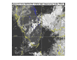
"WATERSPOUT
OVER ST. PETE, FL. COASTLINE"
Click Here For Pictures
- 12/2/9 With the arrival of a large polar high pressure
cell, the morning low in the city of Tampa dropped to 38.1
degrees. This temperature isn't very low by some standards
but for central Florida quite a chill!! A dewpoint of 32.2
degrees and wind chill of 26.4 degrees was quite a wake up call.
- 12/24/99 The temperature this morming a 0600hrs was
45.9 degrees with a wind chill of 39.6 degrees! Pretty chilly
for central Florida. More to come tommorrow morning!
- 11/25/99 With a low of 34.2 degrees,wind chill of 24.9 degrees, and dew point of 30.1 degrees,central Florida was a bit chilly this morning. This is due to several arctic cold fronts that pushed their way through the state over the past
few days. They arrived just in timefor the hollidays.
Ho Ho Ho!!!!!
- 1/11/00 The last three consecutive mornings we have been
greeted to fog. On the 1/9/00 the entire state seemed to be
socked. This was verified from reports on theFlorida weather
ring and a large number of my Ham Radio friends around the state.
Its been unseasonably warm for this time of year.
Most likely due to the influence of "La Nina".
The weather should turn more seasonable toward the
weekend and stay coolfor about 3 weeks.
- 1/15/00 After an extremely breezy several days the
winds have subsided and and the very cool temperatures
have begun to moderate for a time. BP's of 30.62 and 30.55
indicated very heavy & cool Canadian air mass over the
State of Florida. This should moderate some what over the
next several days until the next bout of cold air
moves this direction for thearctic. Brrrr cold but
a welcome change from the very unseasonable
temperatures over the past month.
- 3/19/00 The National Weather Service has issued a
drought warning for several areas in the Southeast to
include the Tampa Bay Area. This is significant because
]there has never been a drought warning issued for this
area since the the NWS has been keepingr ecords for this
area. Hopefully there will be a break in this weather pattern
which has been caused by "La Nina" and the summer rains will
come and break the drought!!
- 4/5/00 Winter is taking its final gasp for the season in
Florida. A last season cold front passed through this area
yesterday bringing with it temperatures of 50 degrees for
lows and a wind chill of 31.8 degrees. Brrr cold!!!!! This
is concidering the heat index has been quite high lately.
This should be the last of the cold weather for the season
in this area.
- 5/9/2000 Another cold front blew through the Tampa Bay
area this morning ushering in another bout of arctic air
(humidity never passed 54% all day) chilly weather late in
the season. Low's in the urban areas were 45.3 Degrees
with winds of approximately 15 mph(wind chill 29.5 degrees)
out of the north. Could this be the last blast
form the north. Only time will tell!!!!
- 6/10/00 As a Result of the La Nina weather pattern,
The extreme drought that has had a stranglehold on North
and Central Florida will go down as the worst since records
have been kept in this area.
At 10 to 12 inches of rain down from normal at this time
of year, it will take at least two good tropical systems
to bring the water supplies of the area back to normal. I
personally observed the water level on the Hillsborough
River being so low that fishermen
have been picking up the fishing lures stuck between
the rocks on the shallow (ankle deep) river bottom.
This sounds a little strange but normally the river
in this arrea is usually 8-10 feet deep! Hopefully
this situation will right itself as the rainy season
approaches.
- 5/2/01 As the "la nina" weather cycle begins to wane,
the hope is that the normal amount of rains will fall on
the Florida penisula later on in the summer, Hopefully
the second half of the rainy season will be greater than
normal amount of rainfall. Keep your fingers crossed.
- 7/1/01 It appears that the long awaited rainy season
Has begun. With 5.50 inches for last month it was welcome
but still more is needed.
- 7/14/01 With passage of unsually strong cold front
through the Tampa Bay area, More much needed rain fell
around the area. Although very little fell in the city of
Tampa itself, much did fall in the rural areas of the the state.


"KEEP AN EYE TO THE SKY"
"LIGHNTNING STRIKES and the HUMAN BODY"
click here
"WEATHER AROUND YOUR NEIGHBORHOOD OR AROUND THE WORLD"
-
THE SOUTHEAST REGIONAL CLIMATE CENTER CLIMATOLOGICAL NORMALS 1961-90
- The South Carolina DNR put this site together. It displays temperature and rainfall morms for the entire southeast U.S.
-
WEST CENTRAL MICHIGAN NOAA WEATHER SERVICE
- Weather Statistics from the Muskegon,Michigan and the rest of West Central Lower Pennisula.
- THE COMMONWEAlTH BUREAU of METEOROLOGY - AUSTRAILIA
- Complete weather website dealing with Austrialia and surrounding area. Excellent site. This is one of those "must see" sites.
- JON'S REALTIME RADAR
- Over 100 realtime radar images from all over the United States. Every major metro area in the U.S. is represented on this site. Probably the best radar coverage on the internet. Check it out! on the
- THE BRISBANE STORM CHASER'S HOMEPAGE
- This website contains over 400 wx photos,wx models animations,forcast,radar loops,archives,Lightning detection and satillite images from SE Queensland. An excellent look at Aussie weather conditions!!
- "KN4LF" HAM RADIO AND WEATHER HOMEPAGE
- Excellent Stats and Graphics. "THE BEST" weather site on the internet!!!
- WFLA CHANNEL 8 WEATHER CENTER
- Excellent coverage of local conditions as well nation wide trends. This site has one of the best doppler radar images in the state and is linked to other weather station as far away a Tallahassee!
- PASCO COUNTY SKYWARN AND AMATEUR RADIO HOMEPAGE
- Many links to the intellecast system of weather coverage
- NOAA GEOSTATIONARY SATALLITES COVERING N.AMERICA AND ADJACENT AREAS
- The best the US government has to offer!!
- ST. PETE TIMES WEATHER GRAPHICS
- Excellent coverage of local and national weather.
- NATIONAL WEATHER SERVICE RUSKIN FLORIDA
- Typical government operation. Has all the necessary info on Florida and surrounding waters.
- PINELLAS COUNTY SKYWARN
- Pinellas county Fl severe weather network
- FLORIDA WEATHER MONITOR
- Great State coverage of issues concerning Florida weather.
- FLORIDA WEATHER
- US Goverment look at Florida weather through the eyes of the National weather Servicee
- ALACHUA COUNTY SKYWARN
- Many links to other weather organizations in the skywarn network.
- WEATHER ON LINE
- Every forcast available. Full screen graphics,maps and other weather info!!!
- THE INTELLICAST WEATHER SERVICE HOMEPAGE
- Worldwide weather in detail. One of the best all-round weather sites around. rund
- TORNADO AND STORM WARNIG HOMEPAGE
- Imporant weather resourcefor peoe living in hurricane and tornado prone areas f he USA.
- NATIONAL WEATHER SERVICE NEWS AND FORCAST
- The official US government weather site.
- THE TORNADO PROJECT ON-LINE
- Here's where you can study all those myths you've heard about tornados
- INTERACTIVE WEATHER INFORMATION NETWORK
- Lots of good graphics and useful information!
- THE TROPICAL PREDICTION CENTER OF THE NATIONAL WEATHER SERVICE
- Excellent tropical weather view. Great during the Hurricane season. See what the N.H.C uses for their predictions.
- CENTRAL ATLANTIC STORM INVESTIGATORS HOMEPAGE
- Great organization.Many links to weather pages nationwide
- STORM PREDICTION CENTER
- Great site with stats and graphics.
- WORLDWIDE HURRICANE CENTER
- This site is a little different from the run-of-the-mill hurricane and severe weather website. You have to take a look! storm
- NOAA WEATHER RADIO
- Written text of the National Weather Service Forcast from Ruskin Fl.
- WORLDWIDE WEATHER AND GLOBAL MONITORING
- Excellent weather site with many unusual links. You must take a look!!!!
- FLORIDA STATE UNIVERSITY TROPICAL PAGE
- The 1999 names from the NWS,weather service storm forcast,satallite graphics for Gulf and Atlantic basin,UN Navy analysis of tropical activity,climatological data and records.
- CENTRAL PACIFIC HURRICANE CENTER
- National Weather Service office in Hawaii.Pacific hurricanes,tropicl summaries,predictions,typhoon warnings,names,all info on storms east of 140w long.
- CHARLES BOLEY's HURRICANES and TROPICAL STORMS
- Atlantic and Pacific tropical activity monitor.Tropical summaries,predictions,names,world satallite images and trcking of all storms. This site has taken a big subject and done very well.
- CNN STORM CENTER
- CNN has once again done their complete and professional coverage of the tropical weather which could effect the USA. Maps,graphics and satallites just to name a few areas are done perfectly. a
- FEDERAL EMERGENCY MANAGEMNT AGENCY(FEMA) TROPICAL STORM WATCH
- Discussion of TD#1,Atlantic outlook,Current Gulf & Atlantic statistics,Forcast for next 10 days and the Pacific outlook.
- THE HURRICANE HUNTERS(53rd RECONNAISSANCE SQUADRON OF THE U.S.A.F RESERVE
- Data on the many storms flown into,aircraft reports,photo gallery,how to intercept reports and the Air Force reserve mission
- PURDUE UNIVERSITY TROPICAL DATA
- Charts,photos,maps,satallite graphics,Dr. Gray's tropical predictions fr 1999,updated reports on tropical activity and much more
- UNIVERSITY OF HAWAII - HURRICANES,TYPHOONS AND TROPICAL CYCLONES
- Excellent site for information on the Pacific tropical season. The highlight of this site is a tracking map that computes and tracks tropical disturbances anywhere in the world.A must to bookmark!!
- WEATHERNET TROPICAL CYCLONE PAGE
- Excellent coverage from a local perspective.Lots of charts,graphs and photos.Well worth a look.
- NORTHEAST MEDIA of ATMOSPHERIC SCIENCE
- Excellent educational site. Articles written by talented staff writers on topics such as Lift factor,soundings,500 mb maps,skew T's,thunderstorms,tornadoes. All this and a weatherforcast too. A must!!
- NATIONAL WEATHER SERVICE HONOLULU HOMEPAGE
- Excellent look at the National Weather Service in Honolulu. This site is an excellent source of information on Pacific hurricanes and typhoons. A MUST SEE!!!!!
- REAL-TIME ENVIRONMENTAL APPLICATIONS & DISPLAY SYSTEM
- Official National Hurricanes Center Tropical Computer Generated Severe Weather Models
|
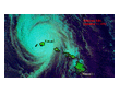
HURRICANES & SEVERE WEATHER


STORM NAMES
A storm acquires a name when its wind speed reaches 39 mph,making it a tropical storm.The names are given by the National Hurricane Center in Miami,which draws up a list for each year.
U.S weather services started giving storms female names in 1953, although military meteorologists had used women's names for storms in the Pacific Ocean during World War II. The feminine names replaced a short-lived practice of using a phonetic - Able, Baker, Charlie - alphabet.
Gender balance came in 1978, when men's names were added for Pacific storms; Atlantic/Gulf storms alternated men's names onto the list in 1979.
Because there were few names that started with Q,U,X,Y and Z, those letters are skipped. Also,some hurricane names have been retired because a storm by that name inflicted heavy damage. The names below are the ones that will be used for the 1999,2000 & 2001 hurricane season.
2001 ATLANTIC HURRICANE NAMES
Allison Felix Karen Pablo Wendy
Barry Gabrelle Lorenzo Rebekah
Chantal Humberto Michelle Sebastian
Dean Iris Noel Tanya
Erin Jerry Olga Van
2000 ATLANTIC HURRICANE NAMES
Alberto Gordon Michael Tony
Beryl Helene Nadine Valerie
Chris Isaac Oscar William
Debby Joyce Patty
Ernesto Keith Rafael
Florence Leslie Sandy
1999 ATLANTIC HURRICANE NAMES
Arlene Harvey Ophelia Tammy
Bret Irene Philippe Vince
Cindy Jose Rita Wilma
Dennis Katrina Stan
Emily Lenny Maria
Floyd Gert Nate
SAFFIR/SIMPSON HURRICANE SCALE
Category Wind Speed Storm Surge
- I 74/95 mph 4/5 ft.
- II 96/110 mph 6/8 ft.
- III 111/130 mph 9/12ft.
- IV 131/155 mph 13/18ft.
- V 155+ mph 18+
TERMS and CLASSIFICATION of UNSTABLE WEATHER
- Tropical Disturbance - First stage of unstable weather which may develope progressively into a hurricane.
- Tropical Depression - The disturbance continues to intensify. A clear defined low pressure area begins to emerge, and the highest wind speed is 38 mph.
- Tropical Storm - The wind speed has increased to 39/73 mph, as the now distinct low pressure area is well defined by rotatng circulation.
- Tropical Storm Watch - An announcement that a tropical storm may pose a threat to coastal areas, generally within 36 hours.
- Tropical Storm Warning - A warning that tropical storm conditions are expected in a specific coastal areas within 24 hours.
- Hurricane - Once a tropical storm's constant wind speed reaches 74 mph or greater, it's classified as a hurricane.
- Hurricane Watch - An announcement that hurricane or hurricane conditions may pose a threat to a coastal area, generally within 3 hours.
- Hurricane Warning - A warning that a hurricane is expected in a specified coastal area within 24 hours.
CREATE A HURRICANE
Click Here
TAMPA BAY COASTAL TIDE HEIGHTS
Month Year Height
- September 1848 15 ft.
- October 1848 12 ft.
- October 1921 10.5ft.
- September 1950 6.5ft.
DEADLIEST FLORIDA HURRICANES
Year Location Dead
- 1928 Lake Okeechobee 1,836
- 1935 Matecumbe Key 408
- 1926 Miami 243
- 1947 Hillsboro Light 17
- 1992 Homestead(Andrew) 17
MOST COSTLY U.S.HURRICANE
Hurricane Year Cost est.
- Andrew 1992 $26.5 billion
- Hugo 1989 $7.0 billion
- Fran 1996 $3.2 billion
- Opal 1995 $3.0 billion
- Frederic 1979 $2.3 billion
DEADLIEST ATLANTIC REGION HURRICANES
Year Location Dead
- 1900 Galveston, Tx 8,000
- 1928 Lake Okeechobee 1,836
- 1928 Florida Keys/Tx 600
- 1938 New England 600
- 1935 Florida Keys 408
The KK4TR Weather Center has been visited  times since 4/1/99.


| Search for the Album or Artist of Your Choice! |
|
|
|
|